Skip to Main Content
CARES HQ
  • Projects
  • Products
    • Map Rooms
    • Assessments
    • Hubs & Widgets
    • Data Services & Consulting
  • About
  • Contact
  • Projects
  • Products
    • Map Rooms
    • Assessments
    • Hubs & Widgets
    • Data Services & Consulting
  • About
  • Contact
27 Jul 2021

CARES Data Viz: Proximity

by ADMIN | posted in: Data Viz | 0

Ever wondered where mobile home parks are located in relation to historic tornado paths?
Well, one of our Research Analysts did and made this great map.

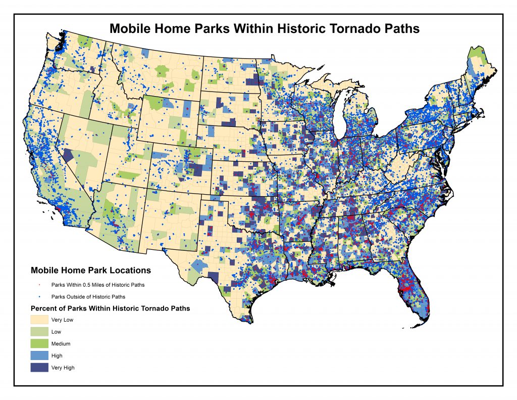
Mobile home park data come from the Homeland Infrastructure Foundation-Level Data (HIFLD).
Historic tornado paths come from National Oceanic and Atmospheric Administration.

map, mobile home, mobile home park, NOAA, tornado, tornado paths

Categories

  • Data Viz
  • Project Updates
CARES extension logo
Have questions? Contact Us!

212 Whitten Hall, Columbia, MO 65211 Tel: 573.882.5735 | Email: kleinsorgej@missouri.edu

© 2021 — Curators of the University of Missouri. All rights reserved. DMCA and other copyright information. An equal opportunity/access/affirmative action/pro-disabled and veteran employer.