
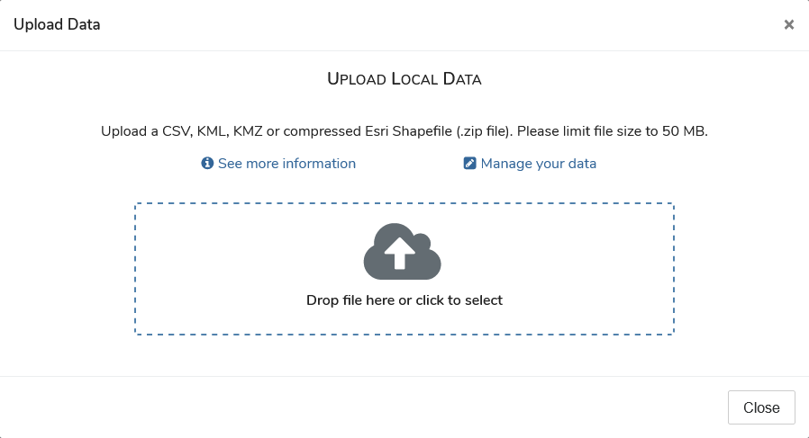
Upload Data
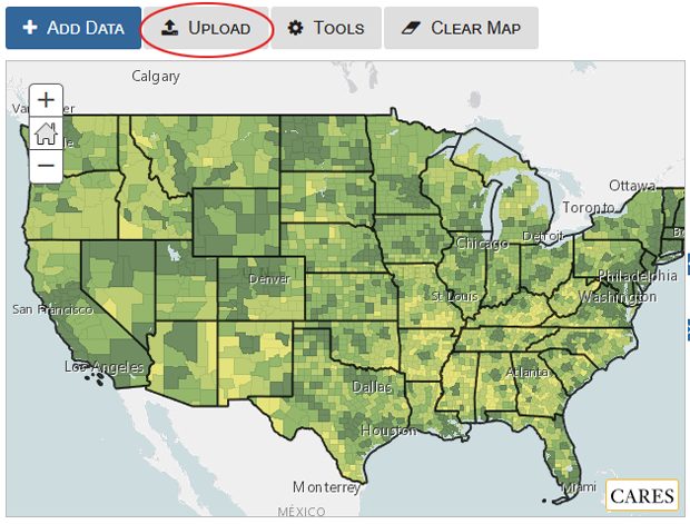
You can upload and visualize your own data in Map Room. To start upload, click the ‘Upload’ button above the top left corner of map.
The accepted file types include CSV, KML, KMZ and Shapefile. Each file is limited to 50MB in storage size for uploading. Once your data file is successfully uploaded, you can set drawing symbols for your data layer and choose what data attributes to display on the map.
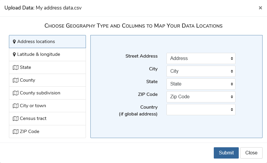
Upload address data
If you have address data in CSV file format, we will geocode the addresses into latitude and longitude coordinates and map your data as point locations.
- Click the ‘Address locations’ option.
- In the ‘Street Address’ dropdown, select the name of street address column. If the street address column contain complete address including city, ZIP Code, and state, skip the remaining column selections.
- In the ‘City’ dropdown, select the name of city column.
- In the ‘ZIP Code’ dropdown, select the name of ZIP Code column.
- In the ‘State’ dropdown, select the name of state column.
- If you are uploading data with global address, select the name of country column.
- Click ‘Submit’ button.
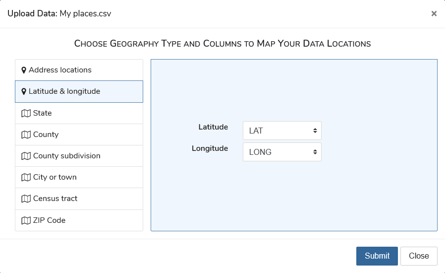
Upload data with latitude and longitude coordinates
If your data contains latitude and longitude coordinates, you can choose these columns during upload process to map your data as point locations. Both columns are required.
- Click the ‘Latitude & longitude’ option.
- In the ‘Latitude’ dropdown, select the name of latitude column.
- In the ‘Longitude’ dropdown, select the name of longitude column.
- Click ‘Submit’ button.
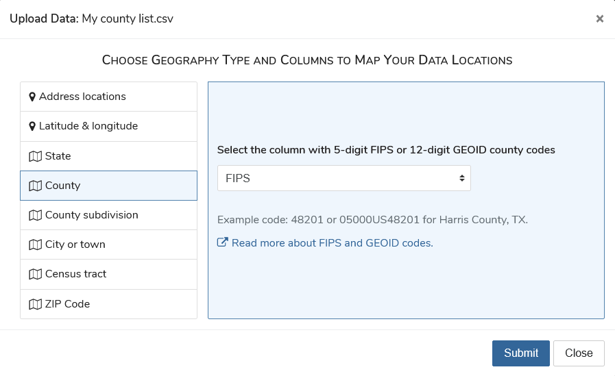
Upload data with census area codes
If your data contains census area codes, such as county FIPS code or census GEOID, you can choose the column to map your data with census geographies.
- Click the area option that matches with your census area codes, i.e. ‘State’, ‘County’, ‘County subdivision’, ‘City or town’, ‘Census tract’, or ‘ZIP Code’.
- Select the name of column that contains census area codes.
- Click ‘Submit’ button.
Upload KML/KMZ file
You can upload a KML or KMZ file to the map room. If the file contains multi-geometry collections, i.e. multiple types of placemarks such as points and polygons, data from the first type of placemarks in the file are extracted.
Upload shapefile
You can upload a shapefile in compressed file format (.zip). The ZIP file must contain all four associated files – .shp, .shx, .dbf and .prj, and is 50MB or less in storage size.